
Automated census-based forest survival analysis tool, providing a complete view of the area between 90 to 120 days after planting.

Discover all Forest Late Control's benefits
-
Eliminate sampling limitations and gain complete insights into forest survival.

-
Identify planting gaps, assess seedling density, and monitor operational quality with geographic precision.
-
Make faster, more informed decisions regarding replanting, stand management, and site renovation based on reliable data.
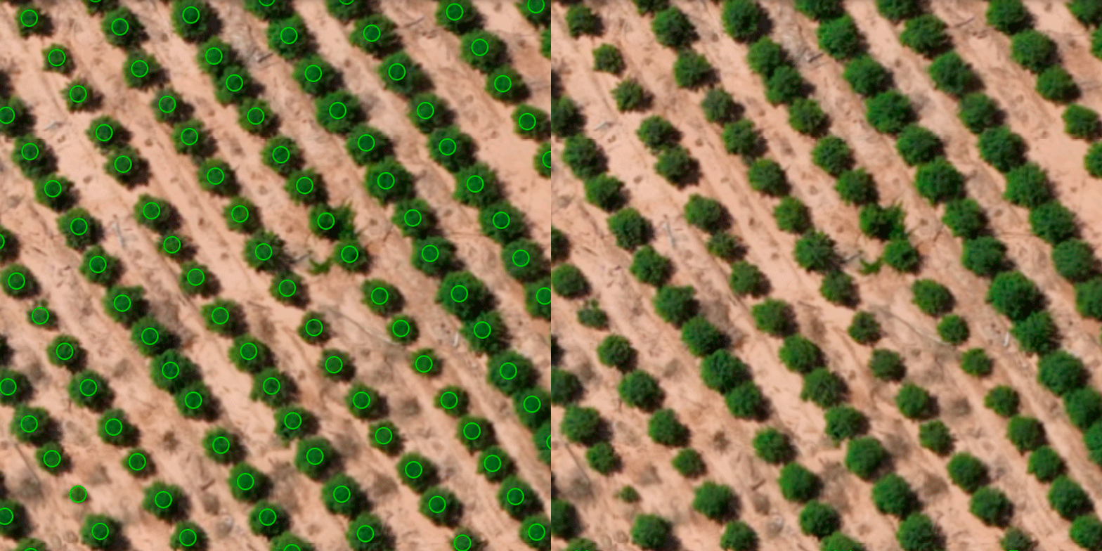
Georeferenced Seedlings
Detect 90 to 120-day-old seedlings with AI-powered accuracy and eliminate manual fieldwork, increasing data reliability through full-census analysis.
Visualize
Access the processed map and view complete stand coverage.
Analyze
Analyze comprehensive stand-level data with the precise location of every seedling.
Decide
Make decisions based on real evidence from georeferenced maps.
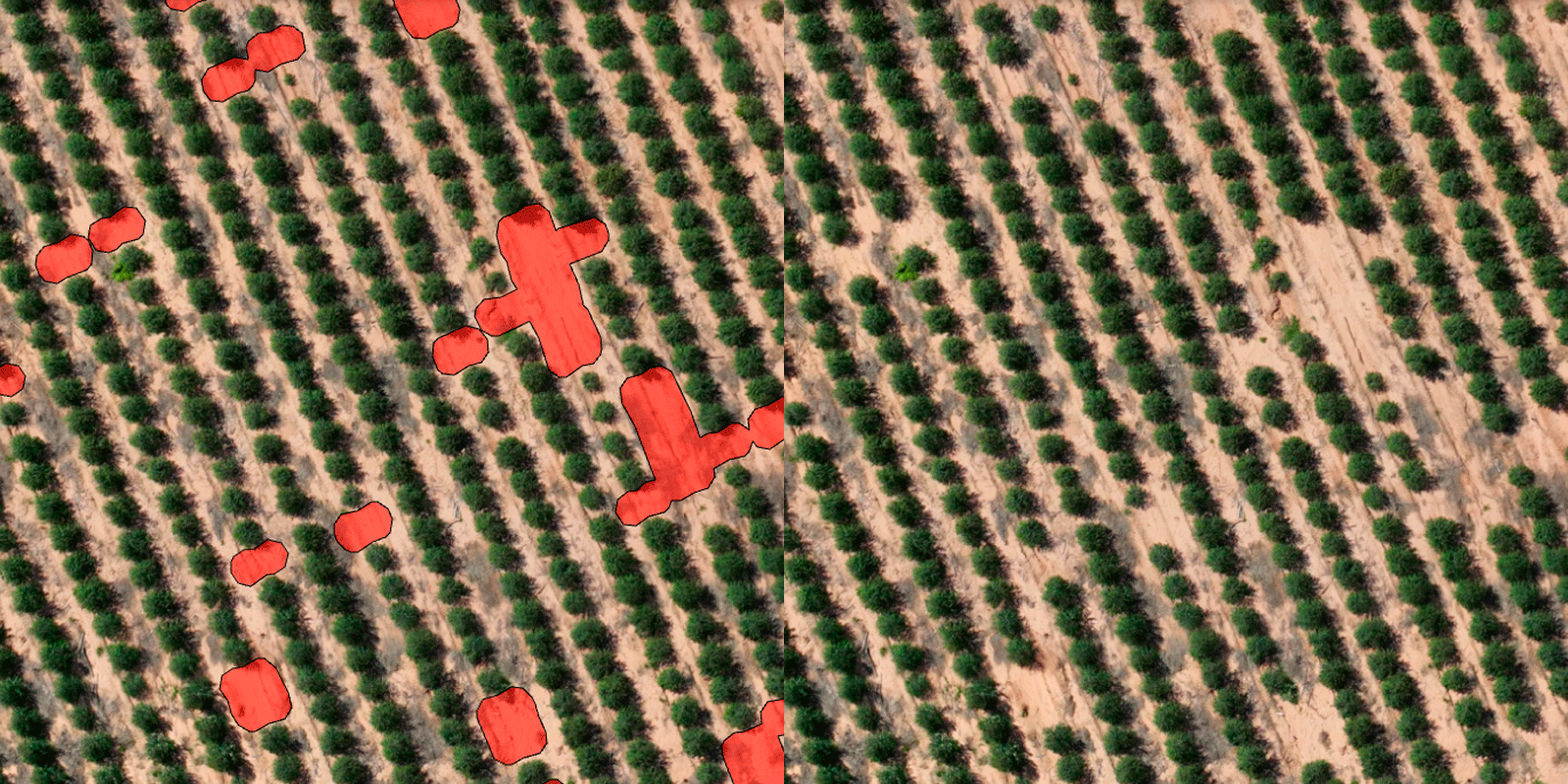
Planting Gaps
Analyze planting gap areas to optimize operations and improve planning and execution with greater accuracy.
Visualize
Access the map and identify planting gaps across forest stands.
Analise
Interact with the results by analyzing gap statistics in acres/hectares and as a percentage of the total mapped area or by stand.
Exporte
Export results quickly and easily.
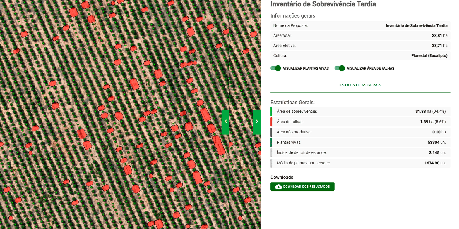
General Statistics
Survival Area
Percentage of the area with surviving seedlings.
Gap Area
Areas with missing seedlings automatically identified by the system.
Non-Productive Area
Areas that were not planted and are included in the calculation of performance indicators.
Live Seedlings
Georeferenced count of detected living seedlings.
Stocking Deficit Index
Measures the replanting requirement needed to achieve the target stocking level.
Average Seedlings per Acre/Hectare
Average seedling density across the analyzed area.
Explore Forest Late Control's Key Features
Georeferenced seedling mapping
Georeferenced planting gap detection
Seedling density per acre
Stocking Index
Escolha seu plano ideal
Arraste para o lado para conhecer
