
Tool for automated mapping and volumetric calculation of forest residues left in the field after extraction.


Discover the advantages of Forest Harvesting
-
Replace manual sampling with automated, census-based analysis.
-
Visualize, filter, and download data directly from the platform with no rework.
-
Turn residues into real value for your operation.
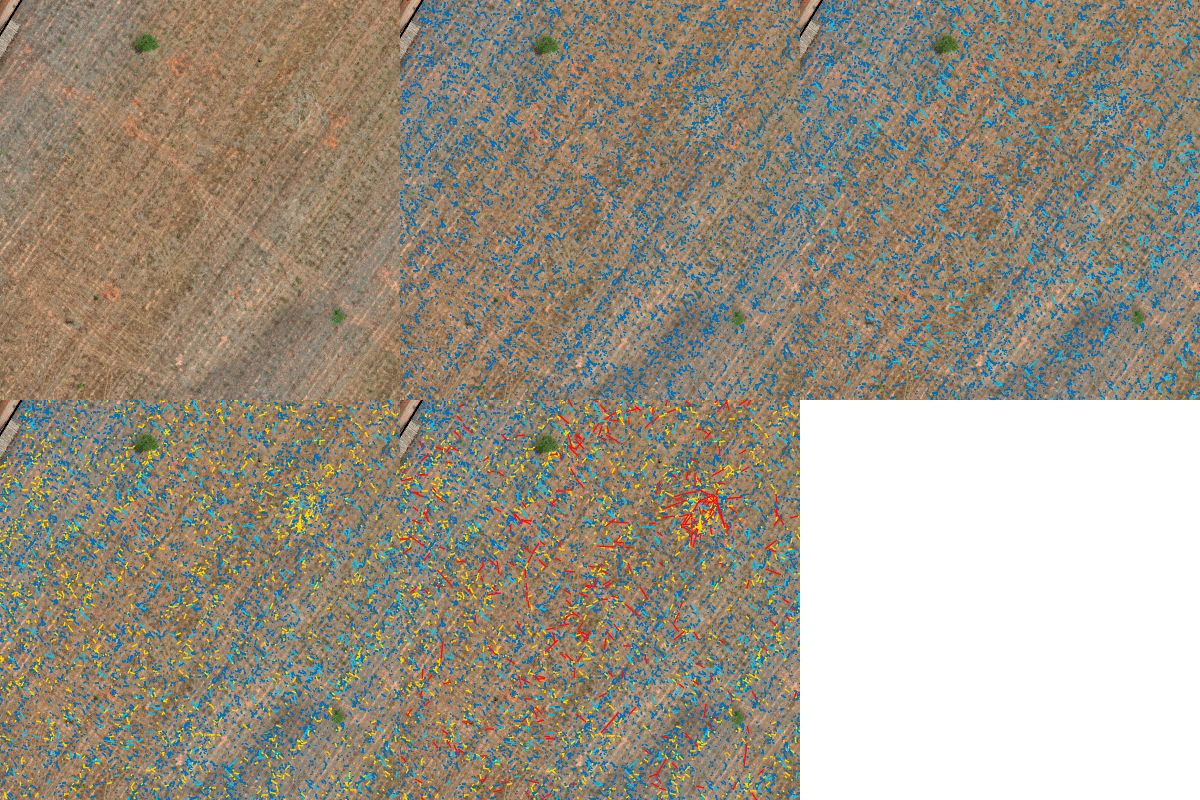
Residue Inventory
Obtain a complete survey of the entire area using AI combined with precise data on volume, count, and distribution of forest residues.
Mapping
Map the entire area with AI and identify how many cubic meters of wood remained in the field after harvesting.
Analysis
View forest residues on the orthomosaic with interactive layers, detailed statistics, and stand-level filters. Perform volume, category, and critical-area analyses with a density map.
Decision
Make data-driven decisions and contribute to greater efficiency in raw material utilization.
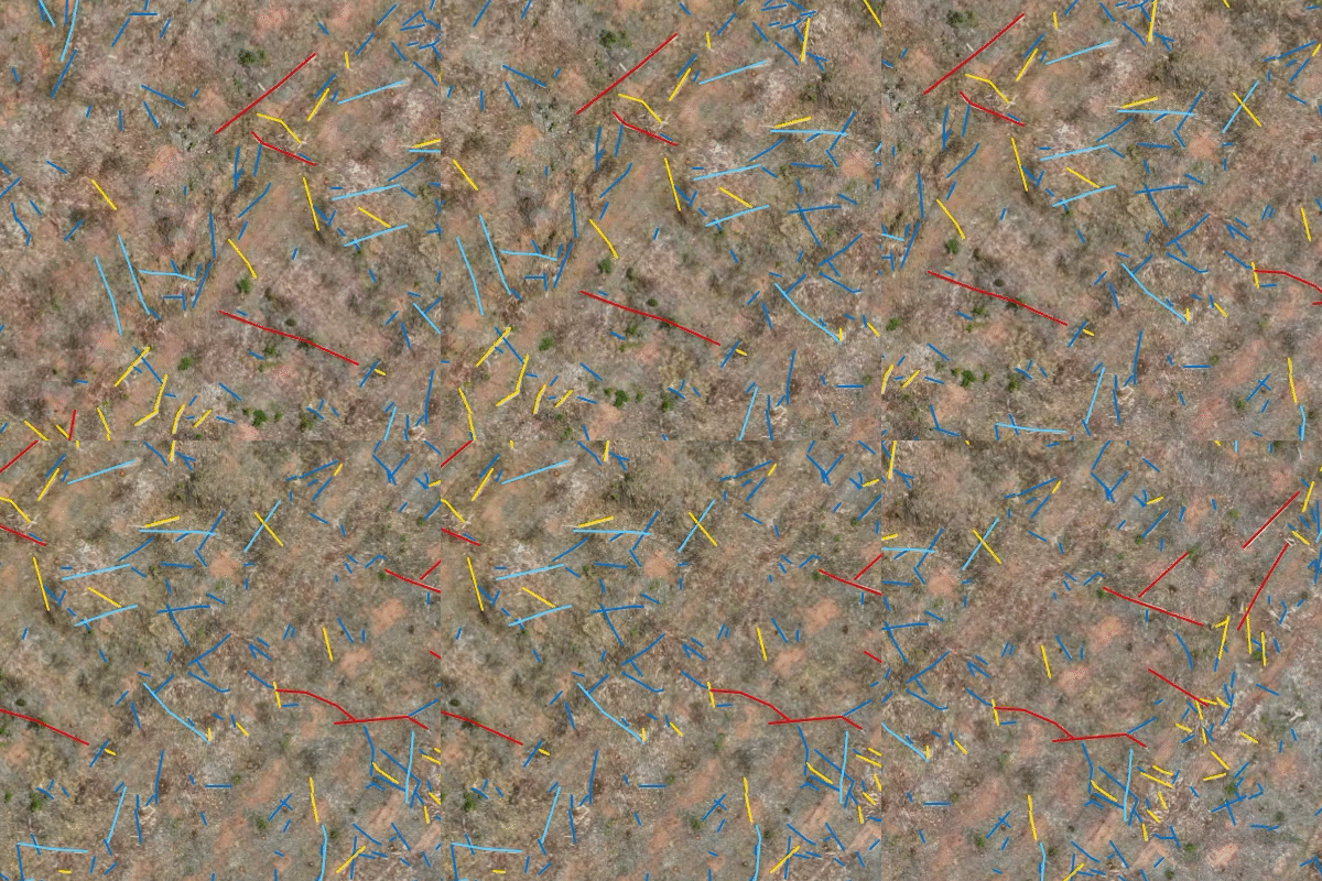
Georeferenced Logs
Access the exact location of each detected log, along with individual attributes such as length, diameter, and volume.
Visualize
View the position of each log on the map.
Analyze
Analyze individual attributes—length, diameter, and volume—per log.
Export
Export all details to ensure precise and optimized operations.
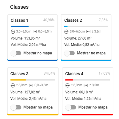
Log Classification
Receive log classification based on custom length and diameter specifications, ensuring standardized and traceable results.
Visualize
Check the generated classes for length and diameter according to your defined parameters.
Analyze
Analyze class distribution and compliance with the customized lengths and diameters.
Export
Quickly and intuitively access and export the log classification.
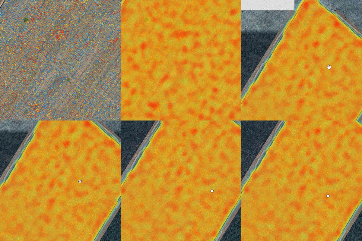
Heat Map
Quickly visualize areas with the highest concentration of residues, making it easier to prioritize collection and optimize operations.
Visualize
Identify points with the highest incidence of residues in the field.
Analyze
Review areas to prioritize collection and enhance operational efficiency.
Export
Export the heat map clearly, quickly, and conveniently.
See the main features Forest Harvesting offers
Residue inventory
Georeferenced logs
Log classification
Heat map
Census-based and automated analysis
Escolha seu plano ideal
Arraste para o lado para conhecer
